Friday, November 2, 2007
Google Earth vs World Wind
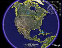
In this primetime matchup, we are pitting Google vs NASA. Naturally, you'd think an agency like NASA would have the better satellite software, but in this case you'd be wrong. Google Earth is the premier aerial map software on the market. It has a smaller download than World Wind and requires much less disk space to be installed. Google Earth has the advantage of being able to incorporate the powerful Google Search into its program.
Thursday, November 1, 2007
What Software do I need for this?
There are a number of companies out there providing this type of software. Some of them provide it to you via their website, while others allow you to download the software to your computer. I'm sure you probably want this for free too, so your 2 best download options are Google Earth from Google, and World Wind from Nasa. If you'd rather use an online program, then Microsoft Terraserver, MSN Virtual Earth and Google Maps are the way to go.
What can I do with this stuff?
Haven't been able to visit all of our National Landmarks? Well now you can with this type of software, and you can see it from all different angles and distances. Imagine what the Grand Canyon looks like from space. Or heck, I wonder what my neighborhood looks like from the clouds. Well why stop there, when you can see your street and all the way down to your house!! Even see what your neighbor has been hiding in his backyard or what this woman might be doing on the roof. 
What is Aerial Mapping?
Wikiepedia defines it as "a geomatics method of collecting information by utilizing aerial photography or from remote sensing imagery using other bands of the electromagnetic spectrum, such as infrared, gamma, or ultraviolet." Ummmm...say what? It's basically just a better version of satellite imaging, pictures taken via a satellite in space.
Subscribe to:
Posts (Atom)